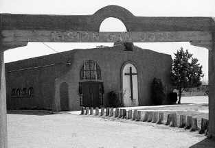
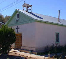
"El Pueblo de la Alameda de San Jose has a fair church and a friary, music and organ, and a poor provision for public workshop; and 400 souls."
 The
above was a status report to the Spanish Crown in the 1660s by an early colonist,
referring to one of the three Tiwa Indian missions located along the Rio Grande.
Later in 1706 Governor Don Francisco Cuervo y Valdez described what is now Albuquerque's
valley as "the last site (frontier) which the Northern Kingdom affords."
Today the Albuquerque newcomer is surprised to find a large green strip between
the Northeast Heights and the West Mesa. The verdant Rio Grande Valley bisects
the east/west population axis of the city.
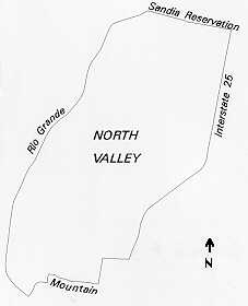
The area of the North Valley encompasses approximately one hundred square miles in the northwest quadrant of metropolitan Albuquerque. The area is bounded by Interstate 40 on the south, Interstate 25 on the east, the Rio Grande on the west, and the Bernalillo/ Sandoval County line on the north. Some would also include the area of Downtown north of Central Avenue, the village of Corrales, and the town of Bernalillo. The environmental character of the North Valley is strongly influenced by the Rio Grande and its associated bosque, the Spanish word for woods. Cottonwood and Russian olive dominate the banks of the Rio, and the bosque they form is considered a wetland. The cottonwood tree is also found throughout the valley along irrigation ditches and drains. The tree is tied to the history and image of the valley as evident in the number and variety of place names that refer to the cottonwood.
 |
Between La Plaza Vieja (Albuquerque's Old Town) to the south and the ancient Sandia Pueblo to the north, were once the Spanish villages of Los Thomases, Los Griegos, Los Duranes, Ranchitos, Los Ranchos and La Alameda. Merchants and tradesmen later came from the eastern states and settled between Old Town and the Santa Fe Railroad tracks. To this day the North Valley remains a rich mixture of Indian, Hispanic, and Anglo cultures. The 1990 census figures show the Hispanic origin population at 55% of the total population in the North Valley.
Early Spanish colonists selected the North Valley with its scattered high grounds for use as farmland. The frequent flooding of lower fields caused drainage problems and deposits of clay silt. Around the time Albuquerque itself was founded in the early eighteenth century, the valley's water table was close to the surface. Bogs near the cultivation fields were called esteos, stagnant water holds. Colonists farmed between them, creating webs of acequias (ditches), which were cleared of heavy silt each year as community projects. The ditches were fed by a larger community ditch, called the acequia madre. The entire network supplied water to the arid fields on slightly higher ground. Today, despite the abundance of ground water just a few feet below the surface, many North Valley lands are irrigated by the same methods as those of the early colonists.
 A
look at old maps of the North Valley reveals hundreds of long narrow parcels
of land each with an end abutting an acequia. These fields, or lineas
as they were called, once supported an active agricultural trade. Post-World
War II farming methods favored larger-scale farms, but valley agriculture continued
to support many individual families from year to year. The North Valley retains
its semi-rural, light agricultural character and some agricultural activity
continues despite subdivision and development. In addition to gardens producing
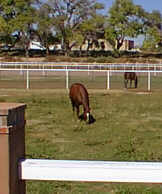
crops primarily for home use, there are numerous horse farms, pastures, and
small-scale animal operations.
The North Valley is unique for the abundant evidence of early settlement and agriculture including acequias, winding streets, long narrow parcels, and older homes. Even in areas where housing densities approach or exceed those of other metropolitan areas, the physical history of the valley has established a unique context for growth. Most of the buildings in the valley occupy land that was once in agricultural use. Unfortunately, the uniform lot sizes and setbacks common to many of today's subdivisions do not reflect the valley's past. In some locations, however, subdivision design includes open space and use of the acequias, thus paying homage to the valley's history and to the only land in the entire region suitable for irrigable agriculture.
 |
Existing housing in the North Valley is diverse in type, quality, size, and price. Residences consist primarily of single-family homes (74%). Very little land is developed with apartments. Fourth Street was once the main north/south route in the region and is now the major commercial shopping area in the valley. The street connects three separate jurisdictions including the City of Albuquerque, the Village of Los Ranchos de Albuquerque, and the land that lies in the unincorporated area of Bernalillo County.
Despite the fact that development trends have shifted the primary growth in the region to the mesas east and west of the river, the Rio Grande Valley remains the historical and cultural heart of the region, transcending the centuries.
(Up to Section II, Back to Central Albuquerque, On to Near Heights)