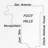
 The
foothills lie between the Sandia Mountain's sharply uplifted, pink granite,
western face and Albuquerque's east mesa. Their fan shaped mounds of granite
gravel are easily eroded. Rushing water from mountain streams carves them, and
road and house construction rearranges them. People value them for their proximity
to the wilderness, the views of the city they provide, and their own quiet beauty.
In protected areas such as the Cibola National Forest, City Open Space, and on other undeveloped land, mule deer and jackrabbits move from arroyos to rises sparsely covered by pinon, juniper, and oak. In spring, deep fuschia cholla flowers and yellow prickly pear cactus flowers dot the landscape. Arroyo banks sprout Apache plume, chamisa and four-wing salt bush. Pine scents the air. Chickadees, jays, and other birds split the quiet with their calls while hawks catch thermals to circle above in the brilliant blue sky. Solitude and introspection are possible here.
City Open Space and the Cibola National Forest conserve natural resources, and environmental features provide opportunities for outdoor education and recreation, shape the urban form by preventing development, conserve archaeological resources, provide trail corridors, and protect the public from natural hazards.
The foothills have long been a popular recreational spot for Albuquerque residents.
Bear Canyon or Whitcomb Springs could be negotiated in a one-day round trip. Each had pure, cold running water, free from pollution, and pine trees and undergrowth that furnished wonderful camping places. On the Fourth of July, it seemed that half the town's population would go to the mountains--on foot, on horseback, by buggy and wagon. . . Bear Canyon was especially popular as it was the closest. Along the lower stretches of the live strea m were cottonwoods, box elders, pinon, and cedar, while farther up were pines and quaking aspen. Perishables were kept cool in the stream. The two or three waterfalls in the stream were everyone's delight. To us children, these were wonderful times, even if we had to walk to get there.
A Boy's Albuquerque by Kenneth C. Balcomb
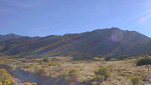 Hiking
and horseback riding are encouraged in the Cibola National Forest and on a developing
city and National Forest Foothills trail for hikers, equestrians, and mountain
bicyclists. The Foothills trail will eventually stretch from north of the Simms
Open Space Park to Interstate 40 (I-40). National Forest trailheads at Embudo
Canyon (the eastern end of Indian School Road) and Embudito Canyon (east on
Montgomery Boulevard, north on Glenwood Hills to entrance) begin in City Open
Space and lead to other trails in the Cibola Forest's mountain wilderness and
eventually to Sandia Crest. Picnic tables are provided in some of the Open Space
areas.
A developing city recreational trail network provides routes for walkers, bicyclists, equestrians, and people with disabilities. The Tramway Boulevard trail is a key part of the network.
Trail and boulevard land acquisition and design were coordinated. The portion of the trail in the Foothills Community was built in the early 1980s.
The trail helped define the character of the foothills area and spurred the construction of other trails throughout the city. Native landscaping, good design, and connection to arroyo trails, neighborhoods, commercial centers, and schools have made it a very popular route for walkers, bicyclists, rollerskaters and others.
Tramway Boulevard was intended as part of a limited-access loop road that was to encircle the city. The Tramway Corridor plan was adopted in the late 1970s, and southern sections of the boulevard (between I-40 and Montgomery) were built in the early 1980s.
From its inception, Tramway was envisioned to be a multiple-purpose corridor accommodating drainage, utilities, a trail, and vehicles. Its right-of-way of 300 ft. is wide enough to accommodate either a high-occupancy lane or fixed rail in the future.
The oldest evidence of human development found in the foothills is several small pueblos from the 13th century. Archeologists call this period of development Pueblo 3. Many of the petroglyphs on the volcanic escarpment on the west mesa were also created during this period.
The east mesa and foothills were used as communal grazing lands by Spanish settlers living in the valley. In the book, Shining River Precious Land, An Oral History of Albuquerque's North Valley by Kathryn Sargeant and Mary Davis, North Valley residents recall how the foothills were still used as grazing land in the early 20th century: "The farmers down in the valley drove their cattle through this common trail (Ranchitos Road) up to the common grazing grounds on the Elena Gallegos Grant." (John Jacobson, 1920s and 1930s) "My grandfather, Eulogio Barela, had two or three hundred head of goats up at Bear Canyon. They were among the last ranchers in the canyon; traces of their homestead are still there." (Ernesto Barela, early 1900s)
In 1938 Albert Simms, a dominant landowner, rancher and farmer in the North Valley, acquired the entire eastern half of the Elena Gallegos Land Grant from James Norment. Norment had acquired the 17,000 acres of land for back taxes in the 1920s. The land lay between what is now Montgomery Boulevard and the Sandia Pueblo boundary and included some of the east mesa, the foothills and Sandia mountains up to the crest. The Elena Gallegos lands were later given to the Albuquerque Academy, providing the financial backbone of the school's endowment.
Farmers Wanted: Up Against the Mountain at Candelaria--Albuquerque Journal classified ad, 1979
 The
city annexed land west of Tramway Boulevard between 1940 and 1949. Land south
of the Embudito Arroyo and east of Tramway was annexed between 1960 and 1969.
The High Desert area north of the Embudito Arroyo was annexed in the 1990s.
The
city annexed land west of Tramway Boulevard between 1940 and 1949. Land south
of the Embudito Arroyo and east of Tramway was annexed between 1960 and 1969.
The High Desert area north of the Embudito Arroyo was annexed in the 1990s.
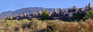
Some of the Foothills community was subdivided as early as 1954 (Rebonito Subdivision 1954 - 1994). Most was subdivided in the 1960s, 1970s, and 1980s. The High Desert is the most recent major subdivision.
The area is generally characterized by residential subdivisions west of Tramway and low-density residential areas in the more rugged foothills east of Tramway. Tanoan is an early Albuquerque example of the phenomenon of gated communities spreading across the U.S.
West of Tramway residential subdivisions are platted within the half-mile grid of the arterial street system. East of Tramway pockets of limited-access, cul-de-sac residential development are separated by the foothills and drainage-ways. Pedestrian and vehicular access is circuitous within the residential neighborhoods, but Tramway and the trail system provide direct access between areas. Neighborhood commercial businesses are located at major intersections along Tramway. (Community Identity Program, Final Report, March 1995)
In 1995 there were fifteen neighborhood associations representing about half of the Foothills area.
Population growth in the Foothills Community brought demand for city services. Park land was dedicated with housing subdivisions. Libraries, schools, and police substations continue to be planned and built.
The City of Albuquerque Open Space program began with the 1969 city goals program. Early efforts to preserve open space included formation of the volunteer Open Space task force.
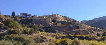 Housing
subdivisions encroaching on the Sandia mountain foothills spurred a public effort
to preserve foothill open space west of the Cibola National Forest boundary.
The city began buying foothills parcels in early 1970s. Local interest in preserving
open space is so great that in the early 1990s the John B. Robert neighborhood
association participated in buying the remaining portions of private land in
the Bear Canyon Arroyo floodplain between Juan Tabo and Tramway Boulevards in
order to convey it to the city's Open Space program.
The City's Bear Canyon Arroyo Corridor Plan was adopted in 1991 to provide policies, regulations and project proposals to guide trail development, open space acquisition, and drainage design along the Bear Canyon Arroyo and other nearby arroyos and arroyo tributaries. Several miles of trail have been completed and others are being designed for construction.
In 1973 a Sandia foothills master plan was adopted by the city. It was amended and became the Sandia Foothills Area Plan in 1978. The area plan was amended again in 1981 and 1982. The plan contains policies to control drainage, erosion, and development in the area east of Tramway between the Embudito Canyon on the north and the military base on the south. The following examples of policies are paraphrased:
 If
public agencies are unable to purchase the land in a reasonable amount of time,
development is allowed if a developer can demonstrate that a future resident
can be protected against landslide, flood, and fire; if developers pay for the
true cost of extending public water, sewer and other services; if street grades
do not exceed 12%; and it permanent drainage facilities are in place. Utility
extension shall be determined as part of the normal Capital Improvements Program
for the city.
Other public policies protecting the foothills are found in the Albuquerque/Bernalillo County Comprehensive Plan. When adopted, the Open Space Facility Plan will also provide guidelines for open space facilities in the foothills.
Two sector development plans direct development in the northern part of the Foothills Community. The Academy/Eubank/Tramway Sector Development Plan adopted in 1980 is for the area between Eubank, Tramway, San Antonio, and the Bear Canyon Arroyo. The High Desert Sector Development Plan adopted in 1994 is for the area between Simms Park Road, the Embudito Arroyo, Tramway and the Cibola National Forest.
(Up to Section II, Back to East Gateway, On to A Community Called Kirtland)